|
Large area boundary surveys
|
Boundary analysis and research
|
|
Lot and parcel surveys
|
Parcel splits
|
|
Land descriptions
|
Record of survey plats
|
|
Subdivision plats
|
Mining claim surveys
|
|
Natural area open space descriptions
|
Subdivision replats
|
|
Reversionary plats
|
Easement locations and descriptions
|
|
ALTA/ACSM land surveys and plats
|
Coordinate geometry computations
|
|
G.P.S. surveys and calibrations
|
Public land system surveys and section subdivisions
|
| |
|
Construction Staking Projects
|
|
Subdivision construction staking
|
Horizontal and vertical control
|
|
Road horizontal and vertical alignment
|
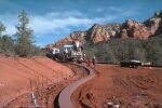
Road construction staking
|
|
Road widening staking
|
Utility and pipeline staking
|
|
House and building layouts
|
Easements
|
|
As-Built surveys and plans
|
Site rough and fine grading
|
|
Utility and pipeline staking
|
Coordinate geometry computations
|
|
Storm sewer and drainage staking
|
Commercial building site staking
|
|
Curb and gutter staking
|
G.P.S. surveys and calibrations
|
| |
|
Topographical Surveying Projects
|
|
Topographical surveys
|
Horizontal and vertical control
|
|
Photogrammetry ground control and paneling
|
Contour and topographical maps
|
|
Benchmark control
|
Floodplain surveying
|
|
Elevation of flood plain property surveys
|
Finish floor and pad certifications
|
|
Monitoring well surveys
|
G.P.S. surveys and calibrations
|